Short-term traffic restrictions from 9:00 AM to 3:00 PM Monday -Thursday next two weeks
FOR IMMEDIATE RELEASE February 28, 2023
Contact: Dave Thompson, 717-418-5018, dmthompson@pa.gov
Sign Structure Inspections Planned on Route 30 in Lancaster County Short-term traffic restrictions from 9:00 AM to 3:00 PM Monday -Thursday next two weeks
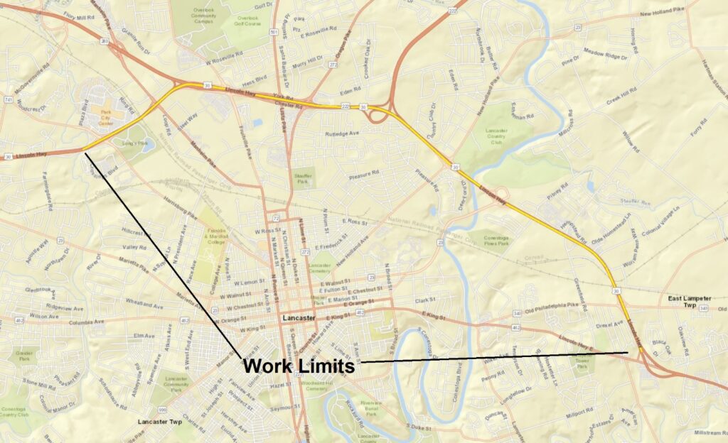
Harrisburg, PA – PennDOT announced today that sign structure inspections are scheduled to begin next week on Route 30 in Lancaster County. The work extends from the exit to Route 741/Millersville/Roherstown east to the intersection of Route 462.
This work will be performed from 9:00 AM to 3:00 PM Monday, March 6 through Thursday, March 9, and will continue the following week, Monday, March 13, through Thursday, March 16.
There will be short-term lane restrictions at various locations in both directions of Route 30 within the work limits. Restrictions will be in one direction at a time.
Motorists should be alert, watch for changing traffic patterns and slow-moving vehicles and drive with caution through the area.
Motorists can check conditions on major roadways by visiting www.511PA.com. 511PA, which is free and available 24 hours a day, provides traffic delay warnings, weather forecasts, traffic speed information and access to more than 1,000 traffic cameras.
511PA is also available through a smartphone application for iPhone and Android devices, by calling 5-1-1, or by following regional Twitter alerts accessible on the 511PA website.
Subscribe to PennDOT news and traffic alerts in Adams, Cumberland, Dauphin, Franklin, Lancaster, Lebanon, Perry, and York counties at PennDOT District 8.
Information about infrastructure in District 8, including completed work and significant projects, is available at District 8 Results. Find PennDOT’s planned and active construction projects at PennDOT Projects.